
Google Maps is one of the most convenient ways convenient to find out the actual distance between two places no matter how far the two places are.
Google Maps will find out all the possible routes and will give you the best route along with the distance and the time it will take to cover the distance.
Find the distance between two places in Google Maps
Even though the Google Maps app is already installed on an Android smartphone, I would recommend that you update it from the Play Store to enjoy all the latest features.
Once you have installed it you can open Google Maps, and type the location in the search bar on the top, Google Maps will come with a few suggestions and you can choose the correct one by tapping on it.
When is the location opens in Google Maps you will get the option to get the directions to that place. It will then show you all the possible routes to go to that place. You can tap on any of that, and it will show you time (which will depend on whether you have selected walking or vehicle in options prior to tapping on the route) as well as the distance.
Find the distance between two places manually on Mobile
Now, often you would want to know the distance between two places by going to a route that is not suggested in Google Maps, fortunately, Google Maps gives you the option to manually find the distance between two places.
For that, you will have to install the Google Earth app from Play Store. The Google Earth app has recently got a new feature called measure tool.
Once you install it, open Google Earth and go to the desired location (if you want to go to your exact location in Google Earth app, you can tap on the Google Earth option from the settings area of Google Maps app).
You can send Tab on the three dots on the top right-hand side, and select the option of major, you will see new tool appear on the screen with options to add a Pont on the Map.
You can put the pin at the desired location, it could be your starting location when you tap on the Add Point button.
(you can add more points whenever there is a turn in the route you want to measure)
You can refer to the video embedded below.
Find the distance between two places manually on desktop
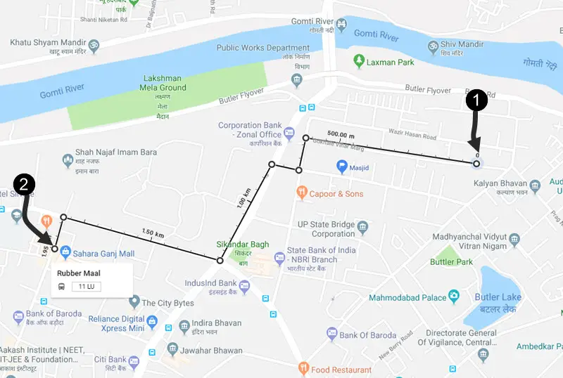
You don’t need to install separate apps to measure distance on your desktop, you can simply open Google Maps and then go to the desired area where both your locations are visible (you can zoom in and out of the map to be precise).
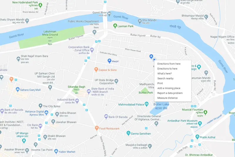
Check the location where you want to start the measure, then right click on it to select the measure option. Now start mapping the route, you can click on the turns to make it precise. Once you reach the destination you will be able to measure the total distance.
So this is how you can calculate the distance between two places even if it is not suggested by Google Maps. This comes quite handy when you know a shortcut and you want to compare the shortcut with the fastest route suggested by Google Maps.
I usually take the help of this feature to know if the new shortcut that I have discovered is worth or not.
Check out more articles about Google Maps and a trick or two about it.